We’re giving thanks, walking together, and inviting you to come along!
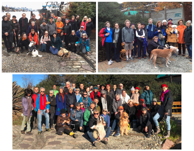
Walk with us on Thanksgiving, November 28, along and around Lake Union in Seattle or wherever you are in gratitude for our communities and for the Native people on whose land we walk. Wherever you walk, think of of us — a wide-spread mesh of people, dispersed but walking together. We need each other more than ever. Drop me an email or add a comment here with a note or photo telling where you are.
(Please see the previous post here for more history and background.)
For Lake Union walkers
If you’re walking with us at Seattle’s Lake Union, we will start at 11:00 am at the Center for Wooden Boats at the south end of the lake. (Parking is right there.) Once gathered, we will walk counterclockwise along the east side of the lake. Please RSVP by email or by adding a comment here to let me know you’re coming so we’ll know to expect you.
Waterway 15— a second “official” place to gather this year
Waterway 15 is an artist -designed park located on Lake Union at its north end. We’re planning to arrive at Waterway 15 between 12:30 and 12:45. If you get there first, please wait for us. Or feel free to join us there if you want a later start. (More about how to find Waterway 15 is below.)
In most of the past 14 years we’ve been making this walk, we’ve stopped here for a “photo op.” See above for sample photo ops from 2014, 2018, and 2019. This year I decided to learn more about where we’d been standing all these years. Waterway 15 was designed in 192 by artist Elizabeth Conner with landscape architect Cliff Willwerth to honor the layers of history at this site. You can learn more here.
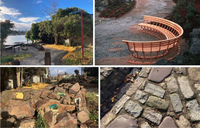
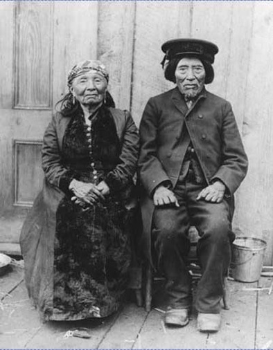
A highlight of the park from the beginning is a beautiful curved wooden bench fabricated at the Center for Wooden Boats that has often been the backdrop for our photos. You can see it peeking out from behind some of the walkers in the photos above. I visited the park recently and was disappointed not to see the bench. Apparently it is currently being restored. It may be back when we walk. The park is also full of small discoveries – recycled bricks carrying messages and ceramic tiles with historic photos, including one tile with a photo of the guiding spirits of our walk, Tleebuleetsa and Cheshiahud, purportedly the last of the Duwamish people to live by the lake. (See the previous post here for more information about them.)
Please join us!
P.S. Finding Waterway 15
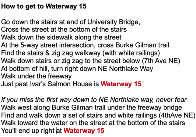
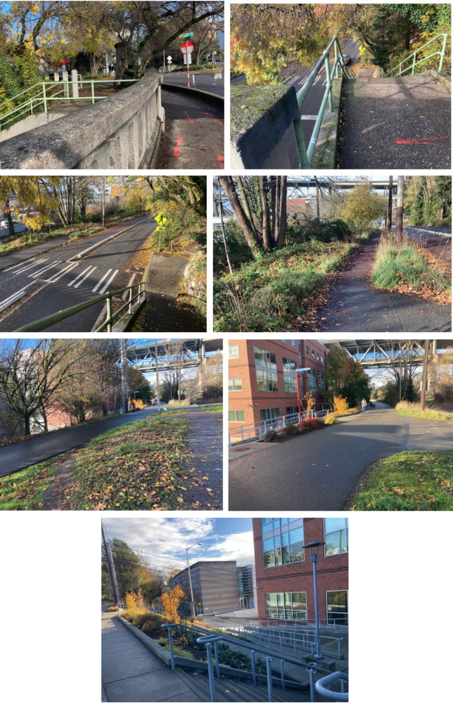
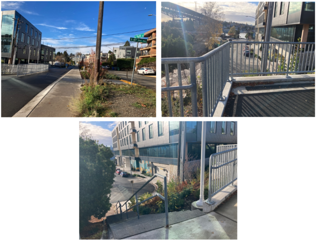
In recent walks, Waterway 15 has proven hard to find. Here’s a map and instructions and photographs that might help:
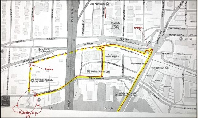
If you miss the first way down, try this:
Thank you for calling attention to the Cheshiahud Lake Union Loop, and for leading convivial walks there which I just learned about today. Please forgive me if I have missed such passages, but perhaps in the future your blog and the walks might reference and even give a little boost to ongoing grassroots efforts at improving pedestrian access and safety around the lake. Below is my neighborhood’s story, but there are also stories in other neighborhoods.
City government’s involvement in improving shoreline access was long predated by the volunteer efforts and donations of residents and local businesses. In Eastlake where I have lived since 1987, the earliest shoreline street-end parks (Newton, Lynn, and Roanoke streets) were started in the early 1970s without the City’s knowledge or support; after chiding the community, the City permitted the improvements, adopted them as official City parks, and further improved them. The street-end parks at Hamlin, Martin (Good Turn) and Louisa streets added between 1990 and 2010 were also community founded and built, but with some City grants.
The four-block park-like shoreline walkway between Newton St. and the Fairview Avenue bridge includes two blocks initially built by the Eastlake Community Council (ECC) with a City grant (some years later, SDOT widened and paved it, and installed railings and lighting). This part of Fairview Avenue E. also includes two blocks of landscaped walkway built by Seattle Public Utilities according to neighborhood plans to settle a legal challenge by ECC.
When the City laid out the Cheshiahud Loop in 2008, it exactly followed the pedestrian route (mostly for walking in the Fairview Avenue E. roadway itself) that the City-funded, community-produced Eastlake Transportation Plan had mapped out in 1994.
The Fairview Avenue E. roadway hosts walking and cycling not only as the Cheshiahud Loop; the City also classifies this roadway as a Neighborhood Green Street and as a Neighborhood Greenway. But pedestrians and cyclists following our neighborhood’s shoreline route still face problems, especially two dangerous intersections (Fairview/Roanoke, and Fairview/Fuhrman) that the City urgently must correct; and a walkway gap of just a fraction of the block between Edgar and Hamlin streets, forcing them to detour dangerously blocks away from the shoreline.
From a public interest web site which I maintain, below are links about the parts of Fairview that need safety improvements, about the shoreline gap, and about the happier story of the walkway between Fairview Ave. N. and Newton Street:
https://eastlakeinfo.net/?page=fairview
https://eastlakeinfo.net/?page=shorepathgap
https://eastlakeinfo.net/?page=fairviewsouth
Again, thanks for your efforts and for the opportunity to comment.
Thank you so much, Chris, for these comments. I love learning more about the places my friends and I have walked since 2010. I started walking around the lake on Thanksgiving by myself four or five years earlier, before the City made it an official trail and named it for Chesiahud. My goal back then was to stay as close to the lake as I could, which means I followed a somewhat different path. I loved discovering all the spots where neighbors and neighborhood groups cared for the lake’s edge and created special places at street ends and other spots. I’ll definitely check out your website! Thanks again.